Our 20th Annual Backbone Trek!

bbtrek info
Hiking the Backbone Trail
on your bucket List?

Our 67 mile trek along the Santa
Monica Mountain's Backbone Trail
takes place in May.

2025 Backbone Trail Trek

Saturday-to-Saturday
May 3rd - May 10th

This year's day 7 of the Backbone Trek will be modified in order to avoid the burn areas at the far east end of the trail. The Palisades fire essentially burned most of day 7's hike, from Rogers Road to Will Rogers State Park. So, the first 6 days of the Trek will follow the Backbone Trail as in previous years, and on day 7, hikers will be led from the last campsite at Musch Camp to a trailhead on the San Fernando Valley side - Marvin Braude Gateway Park.
- BBT Staff

Important Dates
  • February 1 - Registration Opens
  • April 1 - Last day for refund
  • April 8 - Registration Closes

The number of hikers is limited to 25 and registrations are accepted on a first-come first-served basis. There is a registration fee to cover expenses for campgrounds, transportation of personal equipment, insurance, food and the like, with any excess fee going to improve and maintain the trails in the Santa Monica Mountains. The registration fee is $600 per person and includes a one year membership with the Santa Monica Mountains Trails Council.

Useful Links
BBTrek Memories
Refund Policy

Full refunds (minus a $20 cancellation fee) are made if cancellations are Post Marked prior to April 1. No refunds can be given after April 8. Cancellation and request for refund can be made by mail (addressed to the registrar) or by e-mail to brusselars@gmail.com and acknowledged by the registrar.

COVID-19 Policy

Although highly recommended, proof of COVID-19 vaccination is not “required” for the 2025 Backbone Trek. It should be noted however, that the COVID-19 community level for both Ventura and Los Angeles Counties is still rated as “Medium”. All participants are advised to comply with the COVID-19 Prevention Actions published by the Centers for Disease Control and Prevention (CDC). Please do not attend if you test positive within 14 days of, or if you are showing symptoms at the beginning event. A full refund of fees will be provided for COVID-19 related cancellations.

How This Works

In the mornings, hikers prepare their own breakfast, lunch and trail snacks from an assortment of provided "fixings". If needed, our driver will transport you to the trailhead for the days hike.

You carry a daypack with water, snacks and your personal essentials. We provide encouragement and information about the area we are passing thru (plants, geology or historical). Each day of the trek, our volunteers will lead and sweep the hike.

At the end of each day's hike, our volunteers transport you to the campsite of the day. During the time you were hiking, we move your camping equipment between campgrounds.

Accommodations at the campgrounds vary, however, all have potable water, toilets, picnic tables and some have shower facilities. Hot meals prepared by volunteers are served every evening.

While this hike is much less strenuous than a backpack trip, it is not for the casual hiker. Each day's hike is classified as moderate or difficult. However, keep in mind a 10 mile hike every day may have a cumulative effect on one's physical condition, increasing the difficulty as the hike progresses day to day.

We begin the Backbone Trek at Thornhill Broome Beach in Point Mugu State Park. After unloading individual equipment and shuttling private vehicles to a secure parking area, hikers will have an opportunity to meet with the other hikers and the BBT volunteers, share a light dinner and receive an event orientation. Our Backbone Trek culminates this year at Marvin Braude Gateway Park. A light lunch and cool drinks are provided while all participants share their experiences and say good-byes. After lunch, participants are shuttled back to the vehicle parking area to pick up personal camping gear and private autos.
Why We Do This

Since we do not conduct the Backbone Trek as a fund raiser, we are frequently asked, “Why do you do this?” In simple terms, we do this in the hope of creating “Land Stewards”. What is a Land Steward, you may ask. The short definition of a steward is “a person who manages another’s property or affairs”.

The Santa Monica Mountains National Recreation Area, is often referred to as the Nation’s largest urban park. It is over 150,000 acres in size. It’s Mediterranean climate and unique geology supports several plant communities. In turn, this environment supports an amazing wildlife diversity. During the trek you will likely observe over one hundred different blooming species.

We hope that during this hike, you will develop an appreciation for how extremely fortunate we are to have this beautiful wilderness parkland right in our backyard. While enjoying the natural beauty of the mountains, you will also see evidence of the many threats to the environment. These threats take several forms; fires, floods, declining habitat and human development. This park was established by the extremely hard and long efforts of many individuals and organizations. But it is under constant threat from the numerous threats mentioned. If the mountains are to remain the beautiful place that they are, constant vigilance is required by many people or “stewards”. We hope that each Backbone Trek participant will become one of these “stewards” and aid in the management and preservation of the natural beauty of these mountains. Stewardship can be performed in many ways; e.g. direct active volunteering, financial donations to supporting organizations, actively supporting groups and organizations involved in the many activities to protect and manage the parks and by supporting political leaders committed to preserving parkland and the environment in general.

Questions about registration?
Contact Event Registrar,
Barry Dydyk (805) 490-2707 backbonetrek@yahoo.com

Travel Directions

Our meeting place is also the first night's camp. On May 3, we will meet at the Thornhill Broome Beach campground (9000 Pacific Coast Hwy Point Mugu State Park, Malibu, CA 90265), spots 41-45 (just past the campground host). Tell the Park employee at the entry kiosk you’re with the Backbone Trek Group. Plan to arrive between 2:00 P.M. and 4:00 P.M. Come early enough to set up your camp and do a vehicle shuttle to the parking area a few miles away. We will have dinner & orientation at 6:00 P.M. after shuttling vehicles to the secured parking area.

From the North - Take the 101 Freeway to Camarillo and go right (south) on Las Posas Road about 8 miles to Highway 1 (Pacific Coast Hwy). Left on Pacific Coast Hwy about 5.0 miles Thornhill Broome Beach on the right. From the South - There are several ways to access Highway 1 (Pacific Coast Highway) coming from the South. Heading west on Pacific Coast Highway, Thornhill Broome Beach on the left - just over a half mile past Sycamore Cove beach and Sycamore Canyon Campground. Be alert, the entrance should be easy to spot.

Pick up Options – If, at the beginning of the Trek, you are being dropped off at Thornhill Broome Beach Campground, your pickup at the end of the hike can be either at Marvin Braude Mulholland Gateway Park (top of Reseda Blvd-[ 3600 Reseda Blvd, Tarzana, CA 91356) at the south end) or at the secure parking area, at 39996 Pacific Coast Highway (one mile north of Leo Carrillo State Park, on the ocean side of the PCH). The planned arrival at the Marvin Braude Mulholland Gateway Park (MBM Gateway Park) on May 10–– is between 11:30 and 12:30 P.M. If you are getting picked up at MBM Gateway Park, you may grab your lunch bag and hiking gear and go. Your pickup driver is welcome to join us for lunch. If this is the case, please let us know so we can plan enough lunches. There is a nice picnic area adjacent to parking where we will lunch.

NOTE: If you’re driving into the park, be sure to STOP at the Stop Sign in the parking lot. This park is run by MRCA, and they have a Stop Sign camara to insure you stopped and will ticket violators.

If you drive yourself or are getting picked up at the parking area, enjoy your lunch and comradery at MBM Gateway Park. Then everyone hops on the bus for a shuttle to the parking area to meet up with your hiking gear and your vehicle or your ride. The time should be 3 to 3:30 P.M.

BBT Staff

~~ Questions & Answers ~~

Frequently Asked Questions - Submit your Backbone Trek questions to Don Brusselars Click to Send Email to Don Brusselars or registration questions to backbonetrek@yahoo.com.

Are there any paid staff that participate in the annual BBT?
No. The event is organized and run by a dedicated group of volunteers. To keep the registration fee low, we ask each of the hikers to participate in the set-up and cleanup of breakfast, lunch, and dinner. Over the course of the week, each hiker is responsible for three 30 minute shifts. There is a sign-up sheet that will be explained to everyone on the first Saturday of the trek.

What are the toilet facilities like?
Each night we will be camping at an established campground with toilet facilities. There will be periodic "split breaks" on the trail during the day.

Cell Phone Coverage?
There is usually poor cell phone coverage in the campgrounds. However, during the days we will be hiking over and along high ridges, which usually permit cell phone service.

Will there be facilities to recharge the batteries in our cell phone and camera?
Yes. Some of the campgrounds have electric outlets. We will also have a portable charging station available for the other sites. Be sure to bring your adapter for AC or auto outlets.

During the trek, will we be reachable in the event of an emergency?
Prior to the trek, you will be provided with an emergency number which friends or family may use to get in touch in case of an emergency.

Will special dietary needs be accommodated?
Special dietary needs may be accommodated if the staff is notified in advance. Send your requirements to the BBTrek coordinator at backbonetrek@yahoo.com.

I am a slow hiker. How fast is the pace?
We usually maintain a pace of about 2 miles per hour. However, we accommodate hikers of all abilities. There will be plenty of time to enjoy the views, take pictures, etc. Each day's hike is classified as moderate or difficult. However, keep in mind a 10-mile hike every day, with elevation changes, may have a cumulative effect on one's physical condition, increasing the difficulty as the hike progresses day to day.

I am curious about where the camping sites are located. I'm not aware of enough campgrounds spaced at the necessary distances for the hike.
Three of the campgrounds are on or near the trail: La Jolla Group Campground, Danielson Group Campground and Musch Camp. Circle X Group Camp and Malibu Creek Group Camp are not on the trail and for those days a shuttle will be utilized. Campgrounds for each night of the trek are listed in the Itinerary

Will we have to pump water?
No. There is potable water in all the campgrounds. You will have carry your full day's supply each day on the trail.

Will we be exposed to Poison Oak on the Backbone Trail?
Yes. We can expect to encounter Poison Oak on many sections of the trail. All hikers should be sure to bring protective clothing such as long pants and long sleeve shirts. If you are one of those folks who have a reaction to the plant, you should consider bringing a treatment such as "Tecnu®").

Here's a basic list to help you pack for the Backbone Trek. Our checklist is a tried and true minimal list of items to bring. Consider that temperatures can range from a minimum of 48 to a maximum of 103 degrees.

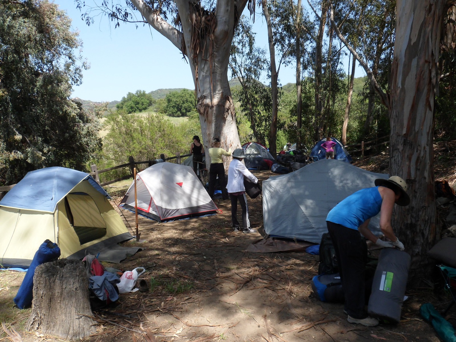
Equipment: Sleeping bag, pad and ground cloth, tarp or tent to protect against insects. A pillow may make your sleeping more comfortable.

Clothing: Rain would be unusual, but coastal fog is likely, so a rain resistant windbreaker with layers should be the best combination. Hiking boots or sturdy walking shoes and good hiking socks for the trail; comfortable shoes to wear in camp; and a hat are musts. It is likely that it will be sunny and hot at least some of the time. Shorts would be OK on most days.

Eating Utensils: Bring your own cup, plate, bowl and eating utensils; plastic container to carry your sandwich and for leftovers; cloth napkin and dish towel.

Personal Items: Bring a towel, soap, shampoo, comb, hairbrush, chap-stick, sunscreen and dental care items. For two days we will be without showers, so you might want to bring a solar shower if a daily shower is important to you.

Basic First Aid: Bring first aid supplies such as bandages, insect repellent, aspirin, moleskin for blister protection and your own special needs. Bring any prescription medications you require.

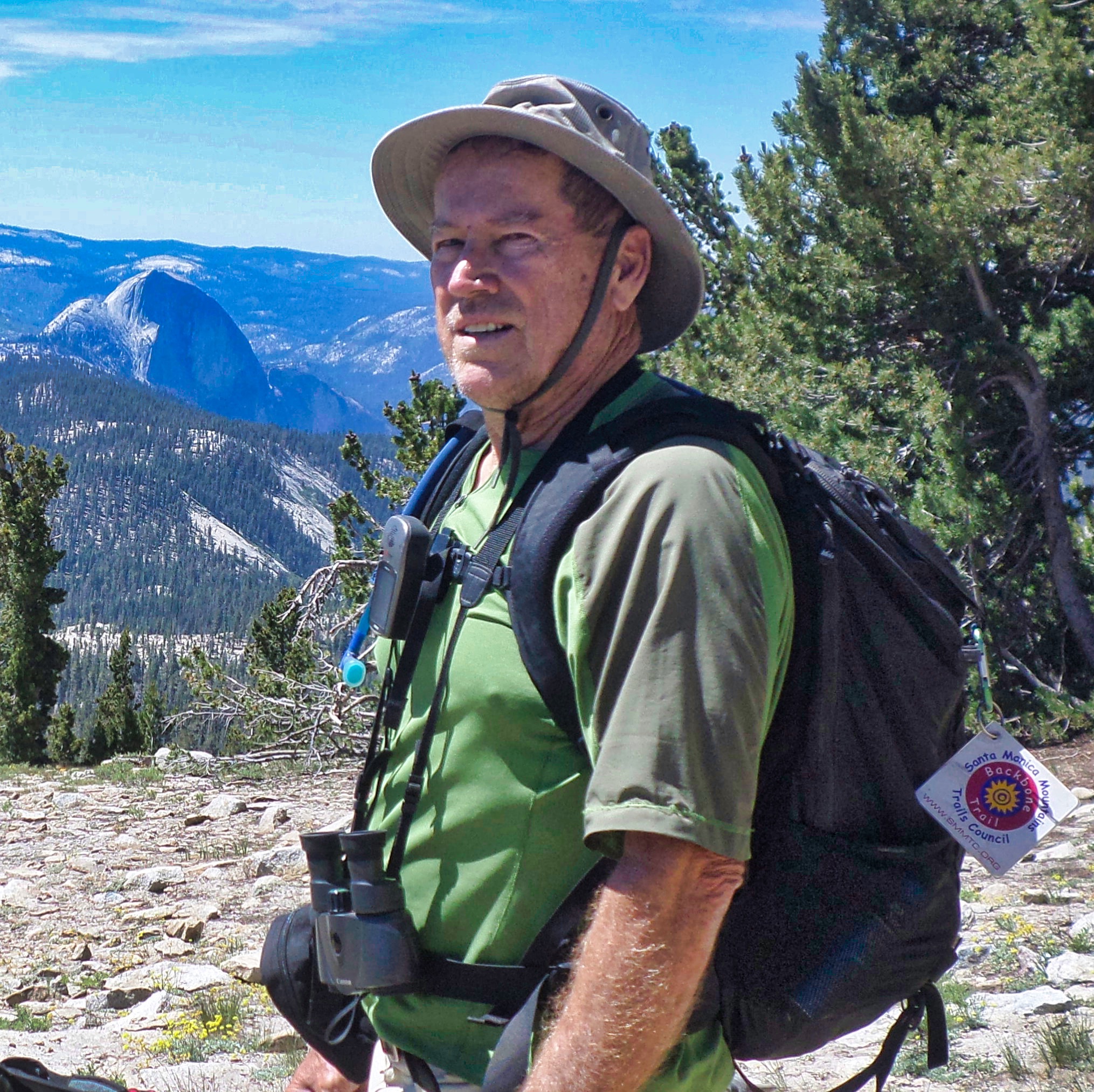
Trail Items: Bring a daypack, 3 liters of water (water bottles or hydration bladder) and sunglasses. Camera, notebook and pen, and binoculars (optional).

Chairs: I recommend one of those lightweight camp seats that fold up into a small cylindrical stuff sack. The stores call them sling chairs or hammock chairs.

Other Stuff: A flashlight and extra batteries are essential. You’ll want some money for extras (we will be making shopping runs during the week.)

The bottom line: We will have a large truck to haul your equipment, so you don't have to be too weight conscious. However, you will have to pack/unpack and load/unload your own equipment each day, so don't bring the kitchen sink.

Optional Activities:
Will there be time on the hikes to do some geocaching?

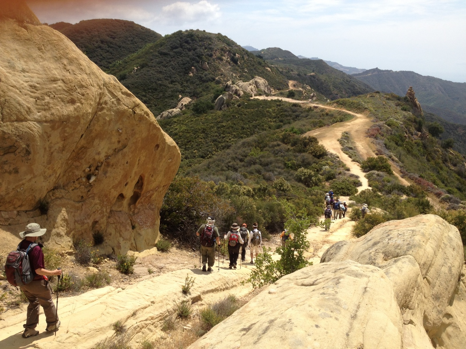
Yes. We will maintain a pace to allow everyone time to enjoy the views, take pictures, geocache, etc.

Do you anticipate there will be many wildflowers to see?
We typically see 140 to 150 blooming species during the hike. Even in low rainfall years we manage to see many different flowers. If you need a reference for wildflowers in the Santa Monica Mountains, we recommend Wildflowers of the Santa Monica Mountains, by Milt McAuley, second edition, 1996.

~~ Itinerary ~~

May 3, 2025   Saturday
Map of area

BBTrek Travel Directions

Our meeting place is also the first night's camp. On May 3th, we will meet at the Thornhill Broome Campground in Point Mugu State Park. Plan to arrive between 2:00 P.M. and 4:00 P.M. Come early enough to set up your camp and do a vehicle shuttle to the parking area a few miles away. We will have dinner & orientation at 6:00 P.M. after shuttling vehicles to the secured parking area.

Drop Off Suggestions - If you are being dropped off at Thornhill Broom, your pickup at the end of the hike can be either at Marvin Braude Gateway Park or at the secure parking area, at 39996 Pacific Coast Highway (one mile north of Leo Carrillo State Park). The planned arrival at Marvin Braude Gateway Park is about 2 - 2:30 P.M. on May 10th, at which time we will have our farewell lunch until 3:30 or so. After lunch, we will have a van shuttle to the secure parking area where you will meet up with your camping gear and vehicles by about 4:30 P.M. Your pickup driver is welcome to take part in the farewell lunch at Marvin Braude Gateway Park.

Camping at Thornhill Broome
Day #1    May 4, 2025    Sunday
Elevation Profile
Thornhill Beach to La Jolla Canyon Backbone Trail, trailhead to Danielson Ranch Group Camp - Moderate: 8.7 miles, 1,330 foot climb

Backbone Trail Odometer Readings

[Begin:0][Miles:8.2][Cumulative:8.2][Gain:1330]

  • Break camp 8:30 AM. This time may be earlier if the predicted high temperature is over 85 degrees
  • Walk half mile to the western terminus of the BBT, hike the Ray Miller Trail to the Overlook Trail (2.7 mi.)
  • Hike Overlook Trail to Wood Canyon Vista Trail (1.9 mi.)
  • Descend Wood Canyon Vista Trail to Big Sycamore Canyon (1.8 mi.)
  • Hike to Danielson Ranch Group Camp, Point Mugu State Park (1.7 mi.)
  • From the Overlook Trail, look to the right for tomorrow's challenge: the ridge line of Boney Mountain 2,000 feet higher
  • Camp at Danielson Ranch Group Camp
  • No shuttle


Camping at Danielson Campground
Day #2    May 5, 2025    Monday
Elevation Profile
Danielson Ranch Group Camp to Triunfo Peak Trailhead - Difficult: 8.4 miles, 3,060 foot climb with the option of including an additional 4.6 mile section of the Backbone Trail for a total of 13.2 miles

Backbone Trail Odometer Readings

[Begin:8.2][Miles:13.2][Gain:3700][Cumulative:21.4,5,030']

  • Break camp 7:00 am
  • Hike up the Blue Canyon and Chamberlain Trails to Chamberlain Rock (3 mi.) and continue (4.5 mi.) up to Sandstone Peak (3,111 ft.), the highest point in the Santa Monica Mountains (and consequently the highest point of the Backbone Trail)
  • Visit Inspiration Point and Sandstone Peak
  • Descend the trail to the Mishe Mokwa Trailhead parking (1.6 mi.). For those hikers that elect to not hike the optional 4.5 miles, a shuttle to the National Park Service’s Circle X Ranch Group Camp will be provided.
  • Optional: For the hikers electing to continue hiking, continue for an additional 4.5 miles from the Mishe Mokwa Trailhead to the Triunfo Peak Trailhead on Yerba Buena Road, with a gentle additional climb and descent of 400 ft. Shuttle to the Circle X Ranch Group Camp.
  • No showers (bring sun shower)
Camping at Circle X Ranch
Day #3    May 6, 2025    Tuesday
Elevation Profile
Triunfo Peak Trailhead to Mulholland Hwy Trailhead to Latigo Canyon Trailhead - Moderate: 12.7 mi., 1,970 ft. climb.

Backbone Trail Odometer Readings

[Begin:21.4][Miles:12.7][Cumulative:34.1]

  • Break camp at 8:00 am
  • Shuttle to the Triunfo Peak trailhead. Hike the BBT to the Etz Meloy Motorway (.5 mi). Hike the Etz Meloy Motorway to a junction with the Backbone Trail (1.3 mi)
  • Hike the single track, unnamed section of the Backbone Trail to Mulholland Highway (2.6 mi.)
  • Hike an unnamed section of Backbone Trail which takes us from Mulholland Hwy to Encinal Canyon Road (1.2 mi.)
  • From Encinal Canyon Road hike Trancas Canyon Trail to the Zuma Ridge Motorway (2.3 mi.)
  • Hike Zuma Ridge Motorway to Zuma Canyon section of the Backbone Trail (0.1 mi.)
  • From the Zuma Ridge Motorway, hike the Upper Zuma Canyon Trail to Kanan Road (2.5 mi.)
  • Continue hiking the Newton Canyon section to the Latigo Canyon Trailhead (2.5 mi.)
  • Shuttle to Malibu Creek State Park Campground
  • Hot showers
Camping at Malibu Creek State Park
Day #4    May 7, 2025    Wednesday
Elevation Profile
Latigo Canyon Trailhead to Malibu Canyon Road Trailhead - Difficult: 9.8 mi., 1,120 ft. climb

Backbone Trail Odometer Readings

[Begin:34.1][Miles:9.8][Cumulative:43.9]

  • Break camp 8:00 am
  • Shuttle to Latigo Trailhead on Latigo Canyon Road
  • From the Latigo Canyon Road hike to Newton Motorway Fire Road (1.4 mi.)
  • From the Newton Motorway Fire Road, hike the Upper Solstice Canyon Trail to Corral Canyon Road (2.7 mi.)
  • From Corral Canyon Road hike the Mesa Peak Fire Road to junction with Puerco Canyon Road (3.0 mi.)
  • From Puerco Canyon Road hike the Mesa Peak Fire Road to Malibu Canyon Road (2.5 mi.)
  • Shuttle to Malibu Creek State Park Campground
  • Hot showers
Camping at Malibu Creek State Park
Day #5    May 8, 2025    Thursday
Elevation Profile
Malibu Creek State Park Campground to Saddle Peak Trailhead - Difficult: 7.1 mi., 2,500 ft. climb

Backbone Trail Odometer Readings

[Begin:43.9][Miles:7.1][Cumulative:51.0]

  • Leave camp 8:00 am
  • Hike the Tapia Spur Trail to the Piuma Road Trailhead (1.2 mi.)
  • From the lower Piuma Road trailhead, hike the Piuma Ridge Trail to the upper Piuma Road trailhead (1.9 mi.)
  • From Piuma Road hike the Saddle Creek and Saddle Peak Trails to Stunt Road (5.2 mi.)
  • Shuttle to Malibu Creek State Park Campground
  • Hot showers
Camping at Malibu Creek State Park
Day #6    May 9, 2025    Friday
Elevation Profile
Saddle Peak Trailhead to Musch Camp - Moderate: 7.6 miles, mostly downhill but includes a 970 foot climb

Backbone Trail Odometer Readings

[Begin:51.0][Miles:7.6][Cumulative:58.6]

  • Break camp 8:00 am
  • Shuttle to the top of Stunt Road
  • From Stunt Road hike the Fossil Ridge Trail to the Hondo Canyon trailhead (0.8 mi.)
  • Hike down Hondo Canyon to Old Topanga Canyon Road (3.8 mi.)
  • From Old Topanga Canyon Rd. hike over Henry Ridge to Topanga Canyon Blvd. (0.7 mi.),
  • From Topanaga Canyon Blvd. Hike through Trippet Ranch to the Musch Camp in Topanga Canyon State Park (2.3 mi.)
  • Camp at Musch Camp
  • No showers (bring sun shower)
Camping at Topanga State Park
Day #7    May 10, 2025    Saturday

Under Revision

Backbone Trail Odometer Readings

[Begin:58.6][Miles:4.8][Cumulative:63.4]

Damage to the Backbone Trail from the Palisades fire will alter our trek this year. Instead of ending at Will Rogers State Historic Park, we will end at Marvin Braude Gateway Park. The last hike will 4.8 miles with 1044 feet of elevation gain and 783 feet of loss.
Filler Stuff - nothing to see here Filler Stuff - nothing to see here

~~ Meet the Principal Backbone Trek Volunteers ~~

Don Brusselars
Don, is an avid geocacher and a trail crew leader. This will be Don's second year as Event Coordinator. Organizing the trek is begun months in advance - this keeps our coordinator busy meticulously making phone calls, sending emails and checking off a list with hundreds of tasks. Don joined the ranks of our trail crew in 2016 and has worked more than 1700 hours! Since joining the board in 2017, Don has been active in helping the board find solutions on a variety of issues.
Event Coordinator
Debi Dold

Debi successfully led her first trek in 2023 and has now completed 12 Backbone treks! She enjoys hiking, sailing, backpacking and camping. She will be there to address any questions you may have and to keep the team moving forward. She feels there are so many great take aways from the trek and her favorite is the life-long friends you make.

Campround Coordinator
Carlyn Taggart
Veteran support staff for the BBTrek who has probably organized more volunteer meals than one could imagine! Able to juggle multiple variables (dietary restrictions, ingredients and staff availability) in her mind while cheerfully lending an ear as you recount the travails of your day. It is said that an army travels on its stomach - Carlyn's focus and strategies in this essential part of every day will set you on the path to succeed on this trek across the Santa Monica Mountains.
Meal Planner and More!
Dave Edwards
Dave is very active with trail work and is the crew master of the Trails Council. He enjoys backpacking in the Sierras and the local Sespe Wilderness. While you are hiking the BBT with us, Dave is a good source of information for the names of Native plants you will come across.
Hike Leader
Barry Dydyk
Retired Systems Engineer from Northrup Grumman. Active in the SMMTC trail maintenance program as a Crew Leader. Barry logs close to 300 hours per year building and maintaining trails in the local mountains. Two years as hiker leader/sweep for the NPS Backbone Trail series. Active with the Boy Scouts of America as an Assistant Scoutmaster. Hobbies: Hiking, backpacking, camping and geocaching.
Event Registrar
Juan Carlo Mendoza
Juan Carlo is an energetic volunteer who has earned California State Parks highest award, volunteers with CORBA, MBU and the Trails Council. He is also a photographer with the Ventura County Star. For 2025, he has graciously volunteered to take on the role of Truck Driver/Wrangler. Juan Carlo makes sure that your gear is transported from campground to campground.
Truck Driver “Wrangler”