Selected Hikes from Milt McAuley
Secret Trail
(from replace)
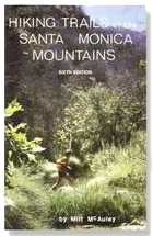
The following is reprinted by permission of the author, Milt McAuley. You can discover more hikes like this in his books on the Santa Monica Mountains. Milt passed away in 2008 but his impact lives on! Remember to always: contact park agency for area specifics, practice the "buddy system", consult a map, wear appropriate clothing, take extra water, and don't disturb or remove anything. Did we mention, Enjoy Yourself!
Maps: SMMTS, Central Section
Distance: 3-1/2 miles
Elevation: 700' gain and loss
Terrain: Trail
Time: 1-1/2 hours
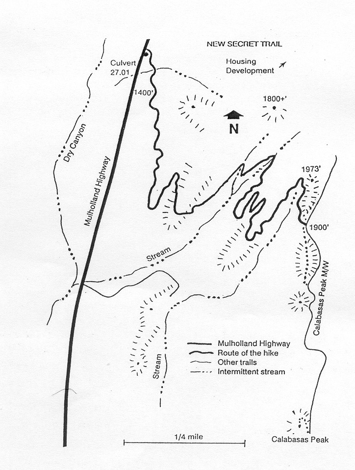
Trailhead: Mulholland Highway
We reach the Trailhead by driving west of Topanga Canyon Boulevard on Mulholland Drive/Highway 4.1 miles. A mileage sign across Mulholland from the trailhead reads mile 27.53. Park on the east side of Mulholland Highway in a dirt lot with room for about 10 cars.
Don't be surprised if the sign at the "New Secret Trail" reads "Calabasas - Cold Creek Trail." In 1985, volunteers built the New Secret Trail to replace the "Secret Trail" which the building of a subdivision was displacing. In the tradition of trail building in the Santa Monica Mountains, the volunteers building a trail name the trail, in this case "New Secret Trail." The old trail had been in use for many years when the developer, Steve Harris, being aware of the trail's existence, offered an easement for a new trail. The Santa Monica Mountains Trails Council President at the time, Linda Palmer, coordinated the project; Ron Webster led the design effort and assembled and led the Sierra Club volunteer crew, Los Angeles County accepted the trail easement, and the Santa Monica Mountains Trails Council agreed to maintain the trail. Not only is this a great trail, but the cooperation of all people and organizations involved shows what can be done when good people get together.
This hike fulfills a need for a nearby, short but challenging walk. It is not designed as a wildflower walk but we will find a wide variety of plants. We will see the largest holly-leaf cherry found locally and an extensive display of spike moss. The spike moss selects volcanic rock on which to grow. Most other plants find an easier foothold.
The trail connects paved Mulholland with Calabasas Motorway (a dirt road on the ridge). We start with some uphill, going through a sage plant community of sumac, buckwheat, purple sage, and sugar bush. For the first ten minutes of the hike the trail winds in and out but parallels Mulholland. We go through a shaded scrub oak forest and cross an intermittent stream. We will find some poison oak near the trail before turning left. Look left as we hike east toward Calabasas Motorway and notice spike moss growing in the volcanic rock. This plant isn't rare but it is the only local species of a family of more than 700 worldwide. This moss prefers sunny slopes and volcanic rock. The technical name is Selaginella biglovii.
We observe but don't collect marine fossils in the sandstone formations along the trail. On a steep switchback area only a few minutes from reaching Calabasas Motorway, look for a large holly-leaf cherry tree on the left side of the trail. Several large trunks sprout from a root crown and form a tree with a 30' spread and about 25' high.
The variety of plant communities en route incudes Coastal Sage Scrub, Southern Oak Woodland, Grassland, Riparian Woodland, Chaparral, and Cliffs. We will be in deep shade at times and exposed to sun and wind at others.
Toward Calabasas Ridge the trail makes several climbing switchbacks and works along some massive sandstone slabs. New Secret Trail intersects Calabasas Peak Motorway, opening opportunities of exploring the ridge in either direction or of climbing Calabasas Peak. For this hike, we turn around at the ridge and return the way we came.
On a day that we feel adventuresome, we could turn right to walk south on the motorway and climb Calabasas Peak. Look around on top for a container holding a sign-in book. To continue south we come to Stunt Road in about one and a half miles. A right turn on Stunt for one mile, then another right turn onto Mulholland and in less than two more miles we have completed a loop back to the car. I don't care to walk on the side of a road so would avoid doing so. A car shuttle is my preference -- or we could go back the way we came.
P.O. BOX 345
Agoura Hills, CA 91376
Email: mail@smmtc.org
Phone: 805-885-7224
SMMTC is a volunteer, tax deductible,nonprofit 501(c)(3) charitable organization
Tax ID: 95-3911604