Selected Hikes from Milt McAuley
NICHOLAS FLAT
(From Decker School Road)
The following is reprinted by permission of the author, Milt McAuley. You can discover more hikes like this in his books on the Santa Monica Mountains. Milt passed away in 2008 but his impact lives on! Remember to always: contact park agency for area specifics, practice the "buddy system", consult a map, wear appropriate clothing, take extra water, and don't disturb or remove anything. Did we mention, Enjoy Yourself!
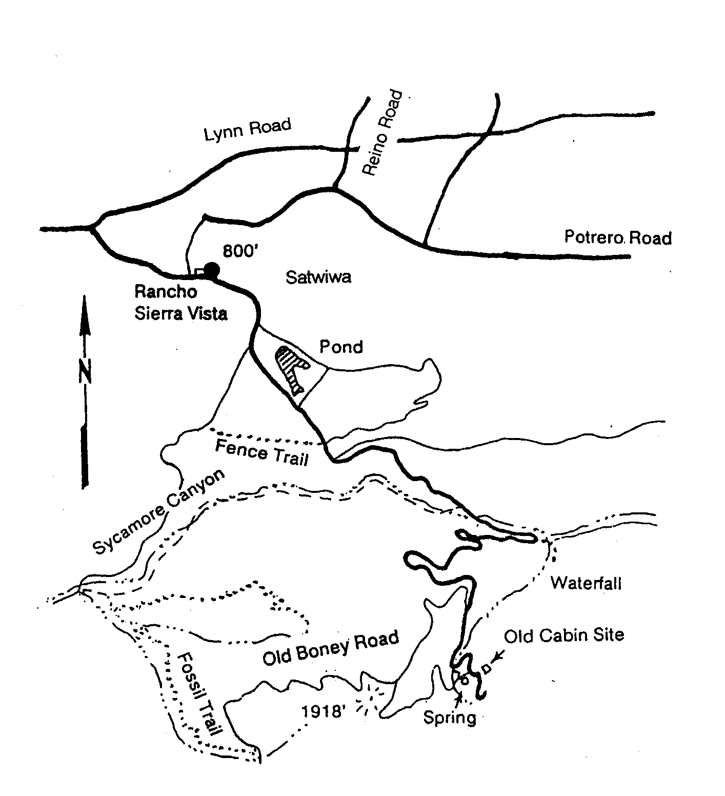
Maps: SMMTS, Western Section
Distance: 8 miles roundtrip
Elevation: 1750' gain, 250' loss
Terrain: Trail
Time: 4 hours
Trailhead: Nicholas Flat - Off Decker Canyon
Hiking trails in the Santa Monicas that actually connect the mountains to the sea are rare, and to find a trail that unrolls scene after scene of new discoveries is rare indeed. The hike can be done as a roundtrip from either end but I prefer starting on the west slope and work uphill. This trail was designed by Ron Webster. If starting from the top - look for Decker School Road.
When we reach a saddle, the saddle splits left to continue north. The trail levels off on the ridge for a few hundred yards then continues up until reaching a gentle part of the trail before it starts leveling off toward the pond. It pays to slow down a bit and my suggestion is to find a tree and some shade.
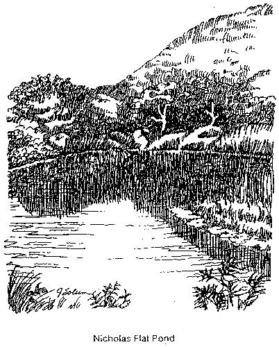
The pond comes as a pleasant surprise. This trail has a beautiful pond on one side, a great meadow on the other, and a fork in the trail leads us to an oak resting place. This entire area shows bedrock mortars and other signs of previous living of Native Americans. I don't know the previous occupation of ownership before the State Park took it over but they made a good selection both in selecting the area and then keeping it well-maintained. When Ron Webster's team went to work they knew what they were doing and the result was well-planned. They still have the touch, after 25 years. Volunteers still have the skill -- that team hasn't slowed down. They built the trail in 1981 and check it out on occasion. That team knows that a hand-hewn trail is special because the sensitivity of the workers is reflected in the final result. Unique rock formations are left undisturbed, trees that add to the beauty are preserved, and the usual evidence of "overkill" that accompanies the use of power equipment is precluded.
The trail makes a big sweeping curve around the north slope of the mountain, losing altitude all the time. For awhile we pass through a dense growth of chaparral, mostly Ceanothus. We will vow to come back in March to witness the blooming of the "wild lilac." The ocean comes into view, and we start a long descent down the slope and out onto a broad ridge. The vegetation makes a transition from Chaparral to Coastal Sage Scrub. The canyon to the west is Arroyo Sequit, and the point of land at the ocean is Sequit Point. The Topanga-Malibu-Sequit Land Grant, first claimed by Jose Bartolome Tapia in 1802 or 1804, took part of the name from Arroyo Sequit. This land grant extended 22 miles along the Malibu coast from Las Flores Canyon to the Los Angeles-Ventura County line and was kept almost intact until the 1930's. Most of the Nicholas Flat Trail is on the old Land Grant land.
We continue downhill toward the ocean, coming out onto a saddle from which two trails branch, one goes east and contours around to the ocean, and the other drops down on the west side. Both of these trails meet again on the south side of the hill near the campground, so we can select either one. Another option is to continue south along the ridge to the top of the hill for a special view of the ocean. Whale watching from this point calls for binoculars.
About Leo Carrillo State Beach and nearby park areas:
Leo Carrillo State Park features both the beach and the back-country. The well-known beach extends for 6600 feet and divides into two separate areas by Sequit Point, a rocky bluff. Both the west beach and east beach have restroom and dressing room facilities. The west beach can accommodate overnight campers in 50 campsites, some for tents, some for recreation vehicles -- but no hookups. Skin diving, swimming, surfing, fishing, and picnicking are popular.
Two campgrounds are north of the highway. One can accommodate 138 family groups in either tents or recreation vehicles. A restroom and shower building is available but no hookups. A group campground can handle 75 people. It has a restroom and shower.
A nature trail starts at the north end of the campground and makes a loop under the trees and up onto the side of the hill. Also, the streambed makes an interesting hiking area. We must do some rock scrambling and take care to avoid Poison Oak. Nevertheless, exploration along the Sequit is a tradition -- the Indians that lived in the village at the stream's mouth used the stream as a corridor for thousands of years.
For those who would plan to camp overnight, make your plans in advance. Leo Carrillo is a well-planned Campground. It may be advisable to stake your camp early.
P.O. BOX 345
Agoura Hills, CA 91376
Email: mail@smmtc.org
Phone: 805-885-7224
SMMTC is a volunteer, tax deductible,nonprofit 501(c)(3) charitable organization
Tax ID: 95-3911604