Selected Hikes from Milt McAuley
Palo Comado Trail
(Sunny Crest Drive Agoura - Oak Park)
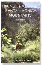
The following is reprinted by permission of the author, Milt McAuley. You can discover more hikes like this in his books on the Santa Monica Mountains. Milt passed away in 2008 but his impact lives on! Remember to always: contact park agency for area specifics, practice the "buddy system", consult a map, wear appropriate clothing, take extra water, and don't disturb or remove anything. Did we mention, Enjoy Yourself!
Maps: National Geographic SMMTS NRA
Distance: 7.5 miles
Elevation: 1050 feet
Terrain: Trail and road
Time: 3 ½ hours
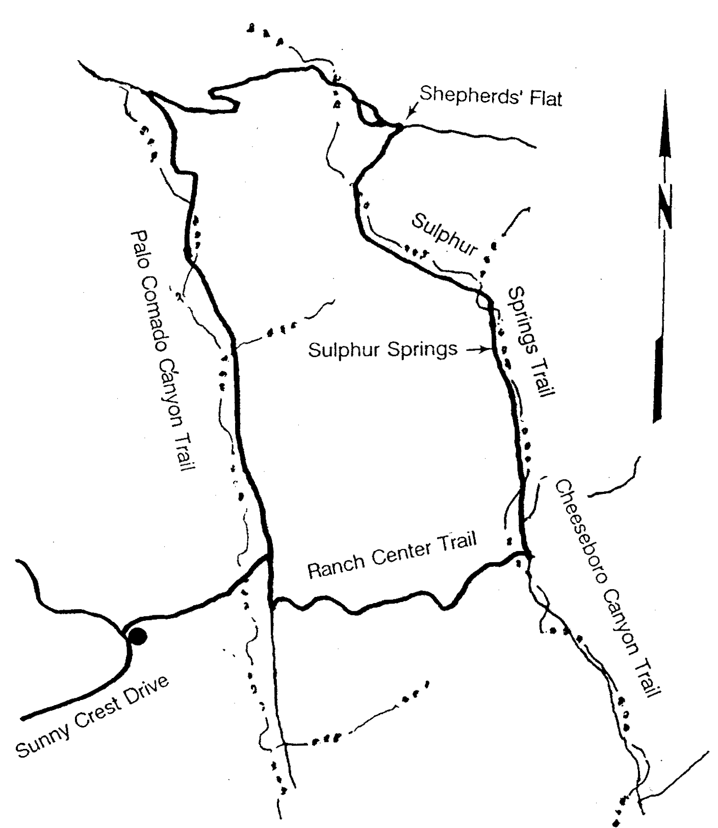
Trailhead: Sunny Crest Drive
Palo Comado Canyon is a north-south canyon with its upper origin at China Flat in the Simi Hills. Today's hike takes us on a counter-clockwise loop into Cheeseboro Canyon and across the head of that canyon back into Palo Comado. Of course this loop may be done clockwise for variety. We locate the Sunny Crest Drive trailhead by turning north on Kanan Road from the Ventura Freeway and drive 1.9 miles. Turn right onto Sunny Crest Drive, go .8 mile, and park at the curb.
A dirt trail goes east uphill over a one-hundred-foot rise, then down the other side to Palo Comado Road (all roads in the Park are dirt). This is a ten minute walk unless the stream is running high, then we always figure out the best way to cross. Turn right on Palo Comado and walk 200 yards where we find a road on our left going uphill and signed "Cheeseboro Canyon", shown as Ranch Center Trail on the map. We are tempted but do not take the first left road -- the one going past a building area. That road takes us to a very steep climb. In the event we do this anyway, we can follow a trail south along the ridge and in 4 minutes reach Ranch Center Trail. Ranch Center Trail gains 400 feet then loses it going down to Cheeseboro Canyon.
We turn left on Cheeseboro Canyon Trail/Sulphur Springs Trail to begin a gentle upstream walk shaded by Oaks and Sycamores. After 350 yards we see the Baleen Wall Trail start up the slope on our right.
Eight to ten minutes later we will see a sign indicating that we stay left to be on the Sulphur Springs Trail. Up until now the stream runs clear but the Sulphur Springs input gives a milky color. This color dilutes out downstream. We don't need to be told when we pass the spring.
Dense riparian woodland transitions to chaparral as the trail climbs out of the canyon. For a while we are on a rocky trail with short steep sections. This levels out soon and when we reach Shepherds' Flat, about one hour after leaving Ranch Center Trail, we are indeed on flat land. turn left and quickly come to a fork in the trail. Both routes meet again. I prefer the left route because we pass several large Oaks that furnish a great place for lunch.
Continuing west, the route goes through mild climbs and descents for about twenty minutes then climbs up the ridge to overlook Palo Comado Canyon. Enroute we pass several trails on our left. We avoid these because of the overgrowth, but one that goes south along a ridge is unusual in that several piles of bleached cow bones can be seen. Our trail angles right and descends to Palo Comado Canyon where we turn left for a gentle downhill mile before it levels out near the stream and in shade of Oaks. One half hour after starting down Palo Comado we look for the trail on the right that takes us to Sunny Crest Trailhead. Fifteen minutes puts us at our cars.
P.O. BOX 345
Agoura Hills, CA 91376
Email: mail@smmtc.org
Phone: 805-885-7224
SMMTC is a volunteer, tax deductible,nonprofit 501(c)(3) charitable organization
Tax ID: 95-3911604